Key Features of :
-
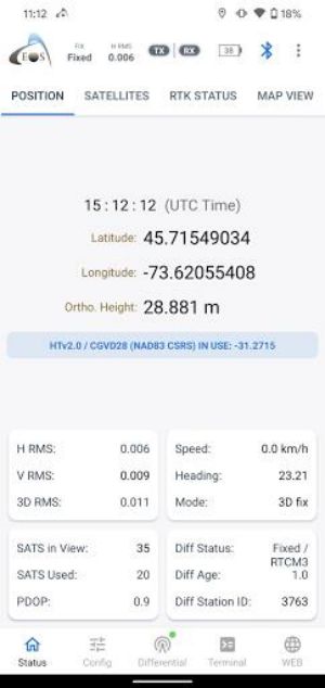
Comprehensive GNSS Data: Access vital GNSS information, including RMS, PDOP, Differential Status, and satellite usage statistics—essential for precise sub-meter and centimeter accuracy in GIS and surveying.
-
Integrated NTRIP Client: Connect to RTK networks for real-time corrections via the built-in NTRIP client, significantly improving positioning accuracy.
-
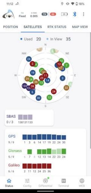
Satellite Visualization: Monitor all active constellations: GPS, GLONASS, BeiDou, Galileo, and QZSS, for a complete picture of satellite positioning.
-
Enhanced Location Services: Provides GNSS metadata to the Location Service using a Mock Provider, boosting location accuracy and overall performance.
-
Customizable Alarms: Configure audible alarms to your preferences, ensuring timely alerts for significant GNSS events and status changes.
-
Terminal & Browser Integration: Utilize the terminal emulator to send configuration commands directly to the receiver. The integrated browser allows for the execution of HTML5 apps.
Summary:
maximizes the accuracy and efficiency of GIS and surveying data acquisition. Its advanced features—comprehensive GNSS data, integrated NTRIP client, satellite visualization, enhanced location services, customizable alarms, and integrated terminal and browser—make it an essential tool for professionals and enthusiasts alike. Download now and experience the power of precise data collection!